 |
| Lightning Strike on Burch Mountain |
Earlier this summer, a lightning strike started a fire on Burch Mountain, above the Wenatchee Valley in Central Washington State. My cousin, Jerry Litt, shared on facebook some stunning photos of the lightning strike. The shots were captured by Michael Bendtsen, a serendipitous and talented photographer who takes pictures for the McGlinn's Public House facebook page. I've asked him if I could share some of his photos here. All the photos on this post are from that facebook page. They are all stunning pictures of Washington. And I apologize that they don't necessarily correlate with the text of this post, but I hope you enjoy them all the same.
 |
| Silver Falls |
You see, I love these pictures. And not just because they are beautiful pictures of beautiful places. Not just because they show a very pleasing sense of composition, or skills with light and perhaps even occasional digital editing.
I'm going to try to explain why these pictures are extra special to me. But it's going to take some time, so travel along with me, through different times and places.
 |
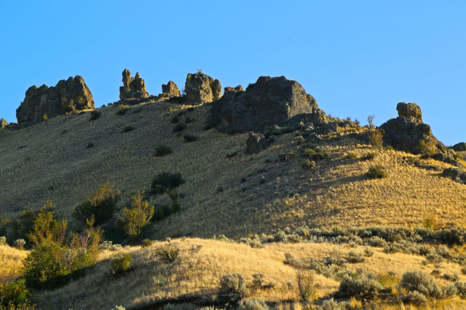
| The Stuarts |
I grew up in Washington State. Most people think of Washington as being a rainy, gray place. And for some, that's as far as their knowledge and opinions go. Others might know there are evergreens there, and mountains. But few realize the vast and varied beauty of the state. It has everything. Truly, I have often thought that there must be few states that have so much texture and variety. The Cascade Mountains, the Olympic Mountains, The Pacific Ocean, Puget Sound, the Columbia River. Forest, desert, plateau, basin, rich river valleys. Berries, tree fruits, truck farms, logging. Shipping, manufacturing, research. Rednecks, hippies, academics, scientists, artists, and regular Joes. And wheat (but that's going to be its own blog post). Even the forests themselves are quite varied, from the lush, mossy rain forest of the Olympic Penninsula, to the Western ranges of the Cascades with their verdant greens and moist forest floors, to the more arid pine forest of the eastern mountain slopes, silver with sage and gold with the dry underbrush. The mountains vary from rugged beauty, to towering peaks, to the rolling foothill ranges of the Western Rockies. Each area has its own unique beauty in the textures and colors of its geography and flora.
 |
| Lupines on Mission Ridge |
Now I live in far northwestern Minnesota. Not too far from Canada. Not too far from North Dakota. Let me just say that the people and communities here are wonderful, and I wouldn't trade them for all the physically beautiful landscapes in the world.
But I do have to confess that I occasionally pine a little bit for the texture and color of the land in which I grew up. You see, it's flat here. Very flat. Very open. Very ... well ... dare I say it? ... visually, a bit boring.
This land has its own kind of beauty, of course. Everything in God's creation has its own beauty. But there is mostly only one kind of beauty here. And one can see it in every direction. For as far as the eye can see. With very few impediments to block the view.
In the summer, the view is of agricultural fields, interspersed with the periodic cluster of trees indicating a farmstead, or an occasional woods. Greens and yellows and russets, depending upon which crop has been planted where, and at what stage of growth it is.
In the winter the landscape is gray and brown and white, depending upon the amount of snowfall. Empty fields. Drifting, blowing snow. Sometimes, when there is not snow, the empty fields lie gray and lonely. And there is always wind.
And it's open. Very open. Very flat. Did I mention that?
But now!
 |
| View from trail to Rock Mountain |
Now!
Suddenly!
Thanks to my cousin, Jerry, and the picture he posted from the McGlinn Public House facebook page, I have an almost daily peek at the many and varied beauties of my home state. You see, besides a periodic post about what's on special at the eatery, and very pretty pictures of the fresh, local produce being used to create those specialties, Mr. Bendtsen hikes around the Wenatchee Valley and its surrounding mountains, and travels around the state. And he takes pictures of the places he goes, and posts them on the eatery's facebook page for anyone to see. For me to see and enjoy. For me to relish the colors and textures of my native Washington.
 |
| Fresh-from-the-trees apricots in the Wenatchee Valley |
 |
| Golden and Green Sage |
 |
| Wenatchee Valley Cherries |
And I do so very much enjoy them. I am so thankful to Jerry for posting the lightning strike photo. He couldn't know what the McGlinn Pulbic House photos would mean to me. And thank you, too, Mr. Bendtsen for your beautiful pictures. And your sense of adventure. I appreciate the freedom that allows you the time to travel all the nooks and crannies for the stunning views to share.
 |
| Another view from the trail to Rock Mountain |
I spent the first six years of my life on the high plateau of central and eastern Washington above the Columbia River valley. I lived in the little, very little, town of Withrow. I suspect that when I lived there the population was less than 50 people. There was a grocery store that also housed the post office, and across the street, owned by the same family, was the gas station. Perhaps it was a service station, as well, but I can't remember for sure. It seemed like kind of a large complex of Quonset or steel/tin or cement block buildings. In the basement of the grocery store was the tavern, which I believe was only open on Friday and Saturday nights, also operated by the same family.
There was a grain elevator at the edge of town, and of course the railroad track ran past.
 |
| Windmill and barn on my cousin's farm near Waterville |
And that was it. The Withrow of my early childhood. It sat surrounded by rolling hills covered with wheatfields, gulches, and the large, jagged, rocky promontories with which that area of Washington is scattered. These jutting rock formations are known as glacial erratics by geologists, but often called haystack rocks by regular people.
The closest towns were half an hour away.
After my parents passed away when I was five and six years old, I moved to the city. To the urban and suburban area south of Seattle, on the west side of the Cascades. Away from my first home and on to my second, to live with my Dad's youngest sister and her family. The city cousins.
The landscape there was much different. Much greener. Much wetter. Much more rolling. Even though we lived in a city area, most of the places we lived were not really too urban or suburban. More, oh, sprawling, maybe. The first home we lived in was in Tacoma, and was probably the most suburban of any of the places we lived during my time in that area. It was in a regular, subdivided neighborhood. Nice neighbors. A mix of large and small yards. Some areas of undeveloped land that were wooded with the lush and verdant trees and plants of the part of Washington that has moderate temperatures and wet winters. The trees, as I recall, were primarily fir and spruce, aspen, alder, and birch. The undergrowth was a variety of berries and ferns, mosses and other greenery.
Many of the yards were wooded. And if they were, they were sure to have a big, red, decomposing log somewhere about. These logs were all kinds of fun. Some homes had them for landscaping purposes only, but we had several that were for play. They were benches, tables, cliffs, and mountains, cars and tractors and school buses. The rotten, red wood-dust was used for various pretend foods, paint for a variety of surfaces, and when mixed with a small amount of water, we declared it a great sculpting medium. We also carved shapes out of the spongy fibers of the logs, and hid in the hollowed out spots.
 |
| Puget Sound area marina |
I've written about the areas where we lived here and here.
 |
| I think this is a view of the Stuarts, too. It's from the Round Mountain Trail. |
Everywhere we went, we saw shapes and textures in the scenery. Trees and forests, hills and mountains, dashing rivers and crashing waterfalls, cliffs and coulees. Blues and greens and browns of every shade. Bays and marinas and inlets and docks and piers.
 |
| Round Mountain Trail |
 |
| Valley view from Mission Ridge |
 |
| Wenatchee River from Horse Lake Road |
 |
| Mission Ridge ski lifts |
 |
| Trail to Saddle Rock |
 |
| Grasses in the sunrise |
A poignant memory I carry with me is of our many trips over the mountains from the Puyallup area, to visit our eastern Washington relatives. I loved that drive. The first part of the trip was through the rolling foothills on the western slopes of the Cascade Range. And then up the highway on the western side of Snoqualmie Pass, on I-90. The foliage was green and full because of the frequent rains that fall from the clouds, as they work their way up and over the mountains. It's very verdant there. The roadways, especially nearer the summit, are often damp. The valleys visible from the highway are sometimes foggy. And as a person approaches the summit, sometimes he must drive into the thick clouds that are trying to squeeze their way through the pass. The mountainsides are steep and the valleys deep. The views from the highway are frequently stunning. But other times, all one can see is the the trees that tower from the depths below, but whose tops sit even with the car windows. The lush foliage is interspersed with rocky cliffs where the melting snows and glacial streams flow down in both rushing waterfalls and small trickles.
 |
| Fenceline along Castlerock Trail |
 |
| Along the way to Saddle Rock, notice the haystack rocks? |
The second half of the route we usually took was through the more arid eastern mountains. We got off I-90 and onto US 97, which goes through Blewett Pass. The high valleys are broad there, and the mountains seem less steep. (Incidentally, this is the area that has been in the news lately because of the Cle Elum wildfire.) The ground is rockier and the foliage, brushier and more scant. The Ponderosa pines grow so tall that the tops are lost far above the highway. Most of these trees are barren of branches until higher up in the forest canopy, so that the primary view from the car windows is of the scrubby underbrush growing at intervals from the thickly-needled forest floor. And the pine trunks. Those beautiful pine trunks with their ruddy colored bark and deeply lined markings in dark black. To this day, a forest of these pine trunks is one of my favorite sights.
Did I mention the air on that pass? The crisp and fresh mountain air is richly infused with the fragrance of pine needles. I can just imagine it, sitting here, remembering.
The route down the far side of Blewett Pass follows the rushing and sometimes crashing Peshastin Creek. It flits along happily beside the highway, under the roadway and out the other side, back under again. And sometimes it even passes under or through one of the rock faces that periodically jut out near the highway. Sometimes The river flows over shallows, with rills and ripples as it skitters across the river bed covered with small rocks rubbed smooth from the rushing waters. Other times it passes, deep and quick, over and around larger jagged rocks and boulders. Oh, how I loved to watch that river. I know it is called a creek, but you must forgive me. It is much grander than some of the rivers that flow near my house.
 |
| Columbia River |
 |
| Rocky Reach Dam and surrounds |
When one gets to the lower foothills of the eastern slopes, she comes to the intersection with US 2. From there she might turn left, to head back over Stevens Pass to the Seattle area, or to stop and visit the popular Bavarian village of Leavenworth. Even if touristy towns are not to a visitor's taste, the hills and mountains around Leavenworth are worth the short drive.
If instead of turning to the left at the above mentioned intersection, one turns right, the road continues to wind steadily downward toward the Columbia River. At this point, the highway follows the Wenatchee River, as it winds its way through fertile orchards of apple, cherry, peach, apricot and pear trees, and past a handful of small orcharding towns. Again, this river is beautiful. Rippling and flowing. Clear and blue.
When a person finally reaches the city of Wenatchee, the valley opens up along the wide and curving Columbia River. The mountains tower to the west. To the east rise the rugged hills and bluffs of the Eastern Plateau. Most of the time these hills are a golden glow. The dried grasses shimmer in the breezes. The silvery green of sage brush dots the landscape, and periodically one can see the darker brown of the rock formations jutting from beneath the soil.
Continuing past Wenatchee on US 2, the road crosses the Columbia, and continues north along her banks, until it turns abruptly to the east to curve and climb up the steep Pine Canyon. Around and up. Boulders and cliffs. When the highway starts its steep ascent, the Pine Creek valley floor is just a bit below the roadway. But gradually, as the road climbs higher, the creek bed slips further and further below. Parts of the old highway are still visible here and there on the other side. Then up and over the last rise, past the last of the rocky formations, and out! Suddenly the land opens up to the broad expanse of the gently rolling wheat fields, and the small city of Waterville.
And with that I will end, since I want to write about the wheat fields and Waterville later. Thanks for accompanying me on this little travelogue to one of the most magnificent places in the United States.
Please visit the McGlinn Public House facebook page to see more such stunning views. And when you're in Wenatchee next, give them your patronage as a thanks. I know I plan to.
2 comments:
I loved reading this post! It is so difficult to explain to people from outside WA why we love it so much here, but you described it beautifully! I've often tried to tell people that we really do have everything here, listing the variety of geographical features, climates, terrain, crops, wildlife, etc. but you tend to fade off as you see the blank looks on their faces. Either they think you are exaggerating or they disbelieve that any of this could make up for the supposed daily drizzle and gloom
Having lived in the midwest for over 3 years through all seasons, I had to smile at your description of the differences and your moments of homesickness. I remember the sense of relief I got while out there when it did finally rain (CLEAN! Finally the air feels clean and fresh and cool!) and how my eyes subconsciously strained constantly for where the mountain (Mt. Rainier, by which all sense of direction is drawn for those of us raised in the Puget Sound area) should be on the horizon.
My first year out at BLC our choir tour went to the Pacific NW, and the sense of HOME I felt was almost overwhelming when I first glimpsed the Vantage Bridge, where the desert plains of eastern Washington meet the green river valleys of the Columbia and the gateway to the passes... A site for sore eyes to any Washingtonian who has been too long from her beloved home state!
Just seeing that view gave me a sense of anticipation, that soon, soon I shall see green again! The greens you only see in Washington, in infinite variety, shades, and hues... http://www.flickr.com/photos/66889257@N00/3744559615/
What lovely descriptions of a place so filled with God's beauty. Thank you for taking time to try to describe His artistry. It makes me want to for sure make a trip out there with our kids, before they are out of the nest! Love you, Mary.
Post a Comment